
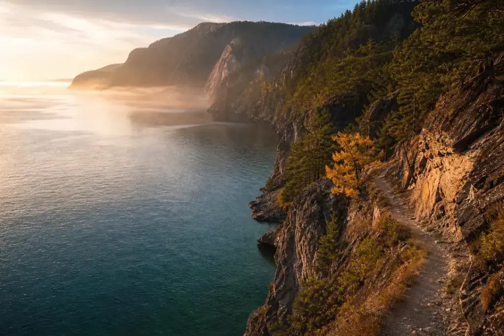
Lake Baikal attracts hikers and nature walkers seeking dramatic shoreline terrain, ancient taiga forests, and panoramic vistas of the world’s deepest freshwater lake. This list covers verified trails and walks across the lake region suitable for different experience levels—day walkers, weekend hikers, and serious trekkers.
The selection includes ten accessible routes across the Pribaikalsky and Zabaikalsky National Parks, plus day walks near major visitor centers like Listvyanka and Olkhon Island. Each trail is verified as currently maintained and open to independent visitors.
At a Glance
| # | Place | Best for | Good to know |
|---|---|---|---|
| 1 | Great Baikal Trail: Listvyanka to Bolshie Koty | Most popular coastal trek | Listvyanka, Irkutsk Oblast; start in village of Listvyanka, return ferry from Bolshie Koty. A permit from Pribaikalsky National Park is required and can be obtained online; allow 5–10 minutes. |
| 2 | Frolikha Adventure Coastline Track (F.A.C.T.) | Remote northern wilderness trek | North shore, Severobaikalsk approach; best accessed via the town of Severobaikalsk. Experienced hikers only; full wilderness camping and food logistics required. |
| 3 | Cape Khoboy Trek, Olkhon Island | Island coastal circuit with dramatic cliffs | Olkhon Island, Khuzhir village; accessible via ferry from Sakhyurta (6–7 hours from Irkutsk by minibus). Organized excursions available locally or can be combined with independent walks. |
| 4 | Three Brothers Rocks (Cape Sagan-Khushun), Olkhon Island | Sacred landmark and coastal walk | Olkhon Island, Khuzhir village; accessible by organized excursion or independent coastal walk. Visible from shore and visible from the lake; winter access requires ice conditions. |
| 5 | Chersky Peak (Khamar-Daban Mountains) | Mountain panorama moderate trek | Khamar-Daban range south of Baikal; accessed from Irkutsk region. Moderate difficulty; approximately 16 hours of hiking time spread over 2–3 days. |
| 6 | Svyatoy Nos Peninsula Trail (Holy Nose) | High-altitude challenging alpine trek | Zabaikalsky National Park, Svyatoy Nos Peninsula; approximately 25 kilometers from the village of Ust-Barguzin. Extreme terrain; suitable only for experienced alpine hikers with technical skills. |
| 7 | Olkhon Island Cross-Island Trek | Transverse forest and steppe walk | Olkhon Island, starting from Khuzhir village; terrain is relatively gentle with soft forest floor. Approximately 4 hours walking time; can be extended to overnight with camping. |
| 8 | Listvyanka to Bolshie Koty Railway Walk | Scenic shoreline stroll with train tunnels | Listvyanka, Irkutsk Oblast; ferries operate seasonally. Flat, easy terrain on both shore and railway. Approximately 8 kilometers of walking plus ferry; full day round trip. |
| 9 | Olkha Plateau Rocks | Short day walk with rock formations | Near Irkutsk, Baikal region; accessible as a day trip. Easy terrain, 6 kilometers total. Best visited in autumn and late summer. |
| 10 | Pribaikalsky National Park Coastal Trail | Protected park shoreline network | Western Baikal shore, Listvyanka area; easy public transport access from Irkutsk. Park permit required (simple process, 5–10 minutes online). More than 50 kilometers of maintained trails available. |
How We Chose
Trails selected meet these criteria:
- Verified as currently maintained and open to visitors as of October 2026
- Located within national park boundaries with clear access from Irkutsk, Listvyanka, or Olkhon Island
- Accessible to day walkers or weekend hikers without specialist mountaineering equipment
- Documented in official park information or reliable trekking sources
- Include a mix of difficulties: easy strolls, moderate day hikes, and challenging multi-day treks
1. Great Baikal Trail: Listvyanka to Bolshie Koty – Most popular coastal trek
The classic section of the Great Baikal Trail, a volunteer-built network encircling Lake Baikal. This 24-kilometer route follows the western shoreline, with trails climbing up to 30 meters above the water before dropping back down to the lakeshore. The path runs through mixed forest and along sandy beaches with frequent views across the lake. Can be completed as a challenging day hike or a comfortable overnight trip, ending in the isolated village of Bolshie Koty, accessible only by ferry or the trail itself.
Good to know: Listvyanka, Irkutsk Oblast; start in village of Listvyanka, return ferry from Bolshie Koty. A permit from Pribaikalsky National Park is required and can be obtained online; allow 5–10 minutes.
Tip: Begin early to avoid a steep climb in afternoon heat. The trail is well maintained and marked but has sections with sharp drops to the lake; not suitable for those uncomfortable with heights or loose footing.
2. Frolikha Adventure Coastline Track (F.A.C.T.) – Remote northern wilderness trek
A 100-kilometer trail in the northeast, built in 2009 by Russian and German volunteers. Intended for experienced hikers over 12 days, this remote route passes through pristine taiga, glacier-fed watercourses, and mountain terrain in and around the Frolikhinsky Reserve. The trail descends toward the mouth of the upper Angara River and passes through habitat for rare species including red-listed Arctic char. Recommended only for well-prepared backcountry hikers with full gear.
Good to know: North shore, Severobaikalsk approach; best accessed via the town of Severobaikalsk. Experienced hikers only; full wilderness camping and food logistics required.
Tip: This is for serious trekkers only. Weather changes rapidly; always have weather gear and check conditions before departure. The terrain is remote with few rescue options.
3. Cape Khoboy Trek, Olkhon Island – Island coastal circuit with dramatic cliffs
A guided or independent walk to Cape Khoboy, the northernmost point of Olkhon Island, known for steep marble cliffs and sweeping views where the two main sections of Baikal meet. The terrain is relatively gentle and follows the shoreline; the area features rocky outcrops, sandy beaches, and steppe grassland. Cape Khoboy stands out as the most striking landmark, offering panoramic photos at sunrise or sunset.
Good to know: Olkhon Island, Khuzhir village; accessible via ferry from Sakhyurta (6–7 hours from Irkutsk by minibus). Organized excursions available locally or can be combined with independent walks.
Tip: Dramatic light and fewer crowds occur in early morning or late afternoon. Bring warm layers even in summer; wind at the cape can be intense, and the cliffs rise steeply over the water.
4. Three Brothers Rocks (Cape Sagan-Khushun), Olkhon Island – Sacred landmark and coastal walk
Three distinctive marble rock formations rising from the western shore of Olkhon Island, about 5 kilometers southwest of Cape Khoboy. The rocks are associated with Buryat shamanic traditions and Baikal's spiritual significance. The site is best viewed from the water or via accessible coastal walks; in winter, ice formations and light effects create spectacular photography.
Good to know: Olkhon Island, Khuzhir village; accessible by organized excursion or independent coastal walk. Visible from shore and visible from the lake; winter access requires ice conditions.
Tip: The rock formation and its setting changes dramatically with light and season. Winter visit offers unique ice and light photography but requires cold-weather preparation and ice stability.
5. Chersky Peak (Khamar-Daban Mountains) – Mountain panorama moderate trek
A 51-kilometer moderate-difficulty route at the foot of Lake Baikal with 1,945 meters of elevation gain, climbing to a mountain peak with sweeping views across the lake and surrounding Siberian terrain. The trail is well-marked and suitable for hikers with previous experience but not technical climbers. Diverse alpine and forest ecosystems along the route.
Good to know: Khamar-Daban range south of Baikal; accessed from Irkutsk region. Moderate difficulty; approximately 16 hours of hiking time spread over 2–3 days.
Tip: This popular route has a well-established camping infrastructure. Begin hiking in early morning for best views at the summit; afternoon clouds often obscure the panorama.
6. Svyatoy Nos Peninsula Trail (Holy Nose) – High-altitude challenging alpine trek
Located within Zabaikalsky National Park on the Svyatoy Nos Peninsula, this extra-difficult route is marked for well-prepared hikers only. The trail climbs to elevations exceeding 1,800 meters above sea level, with sharp inclines and stony terrain. Panoramic views from the plateau overlook Chivyrkuisky Bay and the Ushkany Islands. The ascent and descent span approximately 14 kilometers. Dangerous in rain due to steep slopes and loose rock.
Good to know: Zabaikalsky National Park, Svyatoy Nos Peninsula; approximately 25 kilometers from the village of Ust-Barguzin. Extreme terrain; suitable only for experienced alpine hikers with technical skills.
Tip: Weather is critical on this route. Heavy rain and strong wind create hazardous conditions; always check forecasts before departure and be prepared to turn back if conditions deteriorate. The views from the top are extraordinary but require caution.
7. Olkhon Island Cross-Island Trek – Transverse forest and steppe walk
An easy to moderate walk traversing Olkhon Island from north to south or east to west, moving through taiga forest (dark coniferous trees with soft needle-covered floors), grassland steppe, and open views. Olkhon is 72 kilometers long and 15 kilometers wide, with terrain rising to 800 meters. The cross-island route showcases the island's diverse ecosystems and offers solitude away from the main roads and Cape Khoboy tourist areas.
Good to know: Olkhon Island, starting from Khuzhir village; terrain is relatively gentle with soft forest floor. Approximately 4 hours walking time; can be extended to overnight with camping.
Tip: A map from a local guesthouse is helpful, though trails are not always formally marked. Autumn offers the best colors in the taiga. Bring water and snacks; few services once you leave the village.
8. Listvyanka to Bolshie Koty Railway Walk – Scenic shoreline stroll with train tunnels
An easy walk combining coastal trail and historic Circum-Baikal Railway route. Starting from Listvyanka, walkers follow a flat 5-kilometer path along the Baikal shore, then board a ferry across a narrow strait. On the opposite side, the route continues along or near the historic railway track (built in the early 1900s) that curves along the steep lakeshore, passing through tunnels carved into rock. The return journey is the same route.
Good to know: Listvyanka, Irkutsk Oblast; ferries operate seasonally. Flat, easy terrain on both shore and railway. Approximately 8 kilometers of walking plus ferry; full day round trip.
Tip: The railway tunnels and curves make for excellent photography, especially in early morning light. Check ferry schedules in advance; winter ferry operations depend on ice thickness. The route can become muddy after rain.
9. Olkha Plateau Rocks – Short day walk with rock formations
A 6-kilometer easy to moderate walk on the Olkha Plateau, featuring unique natural rock monuments and panoramic views. The terrain is open with minimal elevation gain, making it accessible for families and casual day-walkers. Located near Irkutsk and the Baikal region, this walk offers a quick escape to natural rock formations and steppe views without requiring backcountry skills.
Good to know: Near Irkutsk, Baikal region; accessible as a day trip. Easy terrain, 6 kilometers total. Best visited in autumn and late summer.
Tip: Rock formations are particularly striking in golden hour light (sunrise or sunset). The walk can be completed quickly, leaving time for a picnic or photography session at scenic overlooks.
10. Pribaikalsky National Park Coastal Trail – Protected park shoreline network
Pribaikalsky National Park encompasses 470 kilometers of the western Baikal coast, including sections of the Great Baikal Trail and numerous other maintained coastal walks. Individual trails range from short strolls to multi-day treks, all following beautiful river valleys, steep cliffs, streams, and sandy bays. The park allows access by permit and features ranger stations and marked routes.
Good to know: Western Baikal shore, Listvyanka area; easy public transport access from Irkutsk. Park permit required (simple process, 5–10 minutes online). More than 50 kilometers of maintained trails available.
Tip: Obtain your park permit before setting out to avoid delays at ranger stations. The park staff can advise on current trail conditions and seasonal closures due to forest fire risk.
Russia Vibes Tips
- National park permits are required for trails within Pribaikalsky and Zabaikalsky National Parks. Permits are straightforward to obtain online from the park's official website and are strictly checked at ranger stations. Allow 5–10 minutes for registration. Forest fire bans may restrict access during high-fire-risk periods in summer; check before departure.
- Listvyanka and Olkhon Island villages have guesthouses and basic services, but remote areas have no water, food, or shelter. Bring all supplies for backcountry treks. Water from Baikal and streams is drinkable in pristine areas but verify with local guides in populated zones.
- Summer (June–August) brings midnight sun conditions in the north and crowds at popular treks. Autumn (September–early October) offers fewer visitors, brilliant taiga colors, and stable weather. Spring and winter require specialized equipment and experience; many trails are snow-covered or inaccessible.
- Olkhon Island and northern trails lack cell coverage in many areas. Download offline maps and consider hiring local guides for navigation. Minibus services to Olkhon run daily from Irkutsk (6–7 hours); book seats in advance during peak season.
- Steep sections with drop-offs are common on coastal trails, particularly the Great Baikal Trail between Listvyanka and Bolshie Koty. Loose rock and muddy patches create hazards after rain. Proper footwear and caution are essential; routes are not suitable for anyone uncomfortable with height or unstable ground.
- Evening light from sunset to dusk is spectacular on Baikal. Plan arrival times to take advantage of golden-hour photography, particularly at Cape Khoboy and Three Brothers Rocks. Dawn light is equally striking and often sees fewer visitors.
Explore Nearby Best Hiking Trails and Nature Walks, Lake Baikal
Sights near Best Hiking Trails and Nature Walks, Lake Baikal
 Listvyanka, Lake Baikal · typical visit: 2–3 days
Main image: AI-generated illustration. It may not show the place exactly as it looks.
 Olkhon Island, Lake Baikal · typical visit: 2–3 days
Main image: AI-generated illustration. It may not show the place exactly as it looks.
 Shamanka Rock, Lake Baikal · typical visit: 30–45 minutesOpen 24 hours
Main image: AI-generated illustration. It may not show the place exactly as it looks.
 Khuzhir, Lake Baikal · typical visit: 2–3 days
Main image: AI-generated illustration. It may not show the place exactly as it looks.
Related guides
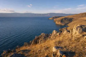 Lake Baikal: Where to Go, What to See and How to Visit
Main image: AI-generated illustration. It may not show the place exactly as it looks.
 Multinsky Lakes Hiking Route: 8-12 Day Trek in the Altai
Main image: AI-generated illustration. It may not show the place exactly as it looks.
 Mount Belukha and Akkem Lake Trek: High Alpine Adventure in the Altai
Main image: AI-generated illustration. It may not show the place exactly as it looks.
 Chulyshman Valley and Katu-Yaryk Pass Route: A 5-Day Mountain Adventure
Main image: AI-generated illustration. It may not show the place exactly as it looks.
 Aktash and Altai Mars Day Trip: Colored Mountains and Thermal Springs
Main image: AI-generated illustration. It may not show the place exactly as it looks.
Browse more: All Guides · All Guides in Lake Baikal · All Lake Baikal · All Viewpoints and Photo Spots
FAQ
Do I need a guide for hiking around Lake Baikal?
No, many trails are well marked and accessible independently. The Great Baikal Trail section from Listvyanka to Bolshie Koty is popular with self-guided hikers. However, a guide is recommended for remote treks like F.A.C.T. and Svyatoy Nos, which have navigation challenges and require backcountry experience. Local guides in Listvyanka and Khuzhir are readily available for hire.
What is the best time of year to hike at Lake Baikal?
June through September offers ice-free conditions and accessible trails. Summer (July–August) brings warm days but also peak crowds and occasional forest fire restrictions. Autumn (September–early October) provides fewer visitors, stable weather, and brilliant foliage. Winter (November–March) requires ice experience; the frozen lake allows ice-walking treks but demands specialized skills and gear.
How do I get to Olkhon Island from Irkutsk?
Daily minibuses depart from central Irkutsk (near the central market) and take approximately 6–7 hours. The route travels 400 kilometers on paved road to the lake, then crosses by ferry to the island, and continues on a dirt road to Khuzhir village. Most minibuses stop at a tavern halfway. Book seats in advance during summer.
Is a permit required for hiking the Great Baikal Trail?
Yes. The trail passes through Pribaikalsky National Park, which requires an entrance permit. Registration is simple and completed online on the park's official website; allow 5–10 minutes. Permits are strictly verified at ranger stations along the trail, so obtain yours before starting.
Can I drink water from Lake Baikal and streams?
In pristine backcountry areas far from settlements, water is drinkable. However, near villages like Listvyanka and Khuzhir, water should be boiled or purified. Ask local guides about specific areas. Bring water purification tablets or a filter as backup.
What is the Pribaikalsky National Park permit process?
Visit the park's official website and register for an entrance pass. The procedure is simple and takes 5–10 minutes. The permit is required before entering park boundaries, particularly when accessing the Great Baikal Trail. Permits are verified at ranger stations and must be carried on the trail.
Are there dangers specific to Baikal hiking?
Coastal trails feature steep cliffs with significant drop-offs and loose rock; proper footwear and caution are essential. Weather changes rapidly, especially at high elevations and near the water; always carry rain gear and check forecasts. Remote northern trails (F.A.C.T., Svyatoy Nos) have limited rescue infrastructure and are suitable only for experienced trekkers. Never hike alone in remote areas.
How are trails organized around Lake Baikal?
Most trails are part of the Great Baikal Trail (GBT), a volunteer-built network encircling the lake. Sections are maintained and marked, with ranger stations and basic camping infrastructure at intervals. Southern trails near Listvyanka are easier to access; northern and eastern trails are more remote. Olkhon Island has short walks and day trips accessible from Khuzhir village.
Russia Vibes is a one-person project. A coffee keeps it going
How we research and update our guides
About this guide: AI assistance and accuracy
This guide is created with the help of AI and is based on official sources where available. Mistakes can still happen. Opening hours, prices, rules and other details are given to the best of our knowledge as of the date shown and can change without notice. It offers general recommendations only, not professional, legal or travel advice. Please confirm important details with the official source before you travel; you are responsible for your own plans and decisions.
Packing for this trip
* Affiliate link: as an Amazon Associate we earn from qualifying purchases at no extra cost to you.

Take this guide with you
Get a free PDF of this guide to print or read offline: key facts, tips and a map link on a few clean pages.
Report an issue on this page
Paying for your trip: please read
International sanctions affect payments between Russia and many other countries. In practice, cards issued in the EU, the UK, the US and several other countries often do not work in Russia, Russian cards usually do not work abroad, and some booking platforms, airlines and payment providers limit or suspend their services for Russia. The situation changes frequently.
We do not give legal or financial advice, and this site does not encourage anyone to break or circumvent sanctions. Whatever you plan, you are responsible for following the laws and regulations that apply to you, including those of your country of residence and citizenship.
Many travelers still organise their stay lawfully. It is worth asking your bank or payment provider what is currently permitted, contacting hotels, tour operators and carriers directly about the payment methods they accept, and checking which services are open to customers from your country. Clarify payment, cancellation and refund terms before you commit to a booking, and keep your plans flexible.
Partner links on this site may not be available in every country, and prices, availability and rules in our guides can differ from what you see when you book.